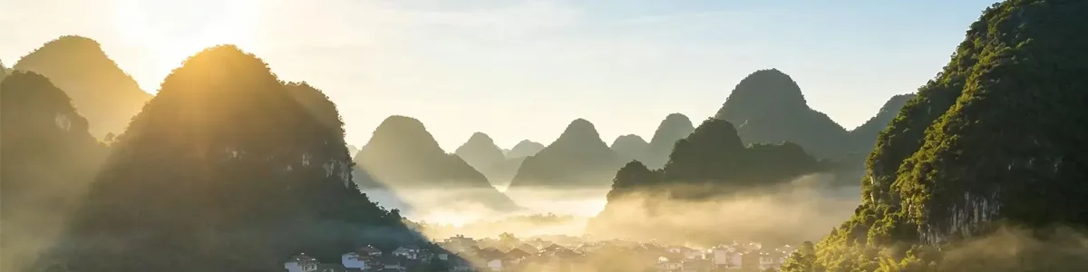
Geography Study Tours in China
Destinations: Beijing, Xi’an (Loess Plateau & Yellow River), Guilin & Yangshuo (Karst)
Tour Features:
This PandaStudyTour geography study tour in China takes students across contrasting geomorphic zones, from the North China Plain and erosion‑shaped Loess Plateau to the water‑carved karst peaks of Guilin. Moving along China's terrain gradient, learners witness first‑hand how climate, rock type and water shape landscapes, while exploring the dynamic interplay between human communities and their physical environment. Blending guided field observation, practical inquiry tasks and collaborative group analysis, this journey turns abstract geography theories into tangible, memorable fieldwork experience that perfectly complements IB, A‑Level and AP geography curricula.
Optional Extension Modules (can add to longer 12–14d version)
- Zhangye, Gansu: Danxia red bed landform, arid‑zone weathering
- Zhangjiajie: Quartz sandstone pillar landform
- Chengdu & Dujiangyan: Basin geography, ancient water diversion, fluvial geomorphology
- Qinghai Lake: Plateau lake, inland drainage basin
Tour Features
- Field geography classroom, not just sightseeing
- Compare 3 core landform types: alluvial plain, loess landform, karst landform
- Focus on human‑environment interaction: soil erosion, water conservancy, karst water system, rural land use
- Professional English‑speaking geography tutor + local guide
- Student workbook, field measurement tasks, group inquiry & final showcase
- Flexible extension: add Zhangye Danxia / Zhangjiajie / Dujiangyan for longer versions
Itinerary:
Day 1 | Arrival in Beijing (North China Plain)
Arrival & airport transfer, welcome briefing, safety training, distribute geography field notebook
Study theme:
North China Plain, China's terrain outline, three topographic stepsVisit: National Museum of China – geography & territory exhibits, ancient flood control
Evening: Pre‑tour map workshop: mark our route, predict landscape changes from north to south
Day 2 | Beijing – Great Wall & Plain Geography
Mutianyu Great Wall field study: mountain boundary, farming‑pastoral transition zone, geomorphic control on ancient defence
Field task: Observe mountain‑plain boundary, record vegetation difference
Wrap‑up: Discussion: How terrain shapes settlement and border geography
Day 3 | Beijing → Xi'an by high‑speed train (Guanzhong Plain, gateway to Loess Plateau)
Train observation: Transition from North China Plain to the edge of Loess Plateau
Afternoon: Shaanxi History Museum: Yellow River basin civilisation, how fertile loess supported early agriculture
Evening: City wall cycling, observe the layout of ancient capital on alluvial plain
Day 4 | Xi'an – Loess Plateau field trip (core geography day)
Drive to the Loess Plateau typical section
Field study: Loess profile, loess tableland (yuan), ridge (liang), hill (mao), gully erosion
Practical activity: Soil sampling, observe loess grain, discuss wind deposition + water erosion
Key topic: Soil erosion, land degradation, terracing & ecological restoration projects
Guided discussion: The challenge of the Yellow River's high sediment load
Day 5 | Xi'an – Yellow River & ancient water engineering
Visit Yellow River viewpoint, learn sediment transport, river deposition, flood plain formation
Optional: Banpo site: early settlement on loess terrace
Workshop: Human adaptation to the Yellow River – risks and opportunities
Day 6 | Xi'an → Guilin by flight (transition from temperate loess zone to subtropical karst zone)
En‑route theme: Climate zone change, rainfall difference, how rainfall drives different landform evolution
Check‑in Guilin; evening Li River riverside walk, introduce karst formation theory
Day 7 | Guilin – Li River cruise & peak forest karst
Li River cruise (Guilin to Yangshuo): Classic fenglin karst landscape
Field task: Identify limestone peaks, river meanders, alluvial fans; locate the 20‑RMB viewpoint
Tutor explanation: Carbonate rock, chemical weathering, dissolution process of karst
Day 8 | Yangshuo – Karst cave & underground hydrology
Visit a large karst cave: Stalactites, stalagmites, underground river
Hands‑on learning: Groundwater cycle in karst, surface‑underground dual drainage system
Afternoon: Yulong River valley survey: karst rural geography, paddy fields, land use in limestone mountain area
Group task: Compare karst erosion vs loess erosion
Day 9 | Yangshuo → Guilin, geography summary workshop
Morning: Countryside transect walk, investigate local agriculture, tourism impact on karst environment
Afternoon: Final group project preparation: Compare the three landform regions we studied
Evening: Student presentation night, award certificates of geography field study
Day 10 | Guilin departure
Closing reflection, farewell, transfer to airport
Included Educational Kit
- Geography field workbook (English)
- Simple field tools: measuring tape, magnifying glass, soil sample bags
- Satellite map & topographic map handouts
- PPT slide deck for pre‑study & post‑tour classroom use
- Official PandaStudyTour geography study certificate